


Maps are like treasure maps for real life—they help us find places, understand distances, and see how different areas connect. If you’ve ever wondered how people know where cities, mountains, and roads are, it’s because of maps! Ghana, a beautiful country in West Africa, has different types of maps that show its borders, roads, landscapes, and more. Whether you’re planning a trip, studying geography, or just curious about the country, the right map can make all the difference.
There are many types of maps, each with a unique purpose. Some help you see where different regions are, others guide you through city streets, and some even show you the heights of mountains. Let’s take a closer look at some of the most useful maps of Ghana and how you can use them.
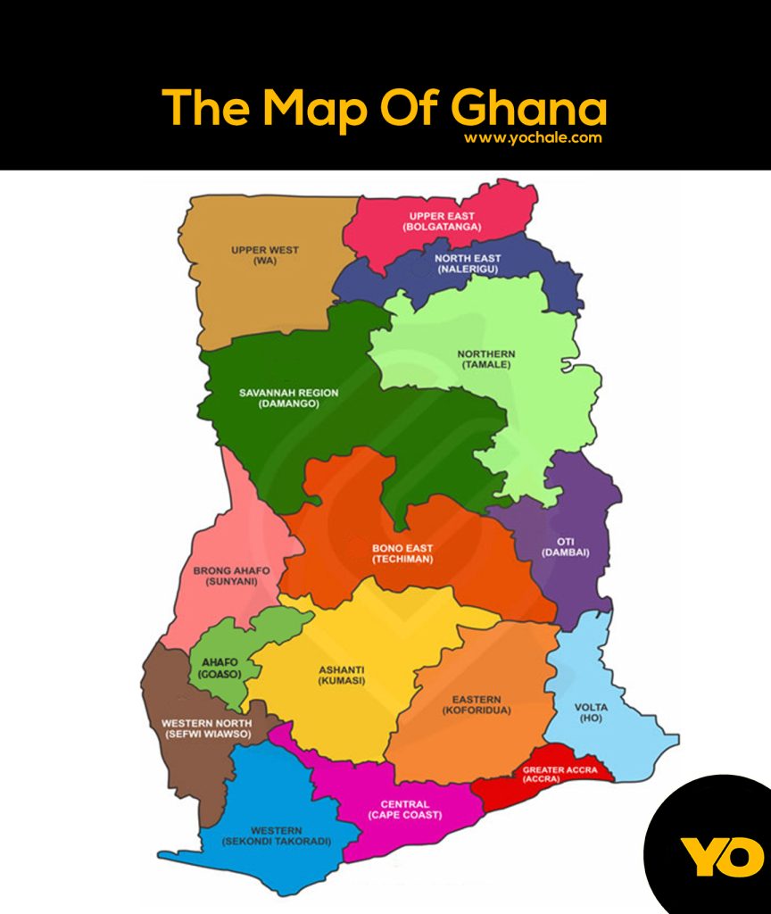
Political and Regional Maps of Ghana
A political map shows the boundaries of a country, its regions, and major cities. Ghana has 16 regions, each with its own capital and unique culture. If you look at a political map of Ghana, you’ll see clear lines marking where one region ends and another begins.
| Region | Capital |
|---|---|
| Greater Accra Region | Accra |
| Ashanti Region | Kumasi |
| Northern Region | Tamale |
| Western Region | Sekondi-Takoradi |
| Eastern Region | Koforidua |
| Volta Region | Ho |
| Central Region | Cape Coast |
| Bono Region | Sunyani |
| Upper East Region | Bolgatanga |
| Upper West Region | Wa |
| Savannah Region | Damongo |
| North East Region | Nalerigu |
| Oti Region | Dambai |
| Bono East Region | Techiman |
| Western North Region | Sefwi Wiawso |
| Ahafo Region | Goaso |
With a regional map, you can easily spot which areas are close to each other and where the country’s major cities are located.
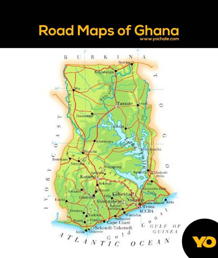
Road Maps of Ghana
A road map is essential if you’re traveling within Ghana. Whether you’re driving from Accra to Kumasi or heading to a small village, road maps show how different places are connected. Ghana’s roads are divided into major highways and minor roads.
Major Highways in Ghana
These roads connect big cities and make long-distance travel easier:
- N1 Highway: Runs from Aflao in the east to Elubo in the west, passing through Accra and Takoradi.
- N6 Highway: Connects Accra to Kumasi, Ghana’s second-largest city.
- N10 Highway: Links Kumasi to Tamale, making travel to the northern parts of the country more accessible.
Minor Roads and Rural Routes
Smaller roads connect towns and villages, helping people move goods, visit family, or travel for work. These roads may not always be paved, especially in rural areas, but they are crucial for reaching less-populated parts of Ghana.
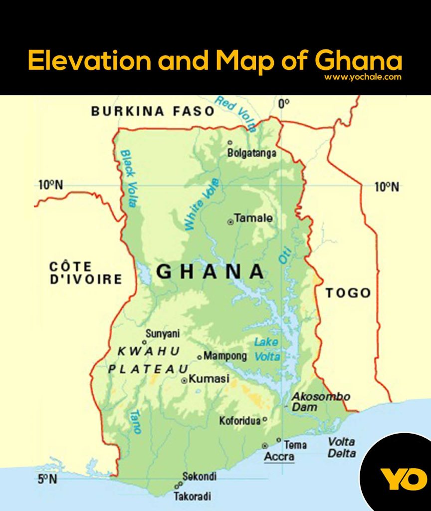
Elevation and Topographic Map of Ghana
An elevation map shows how high or low the land is. Ghana’s landscape is not completely flat—some areas are higher than others, and this affects the climate and travel conditions.
High and Low Elevation Areas
- Lowlands: The coastal areas, including Accra, are mostly flat and close to sea level.
- Hilly Areas: The Ashanti and Eastern Regions have rolling hills, which make for scenic views.
- Mountainous Areas: The Akwapim-Togo Range runs through the eastern part of Ghana, with Mount Afadja (Afadjato) as the highest peak at 885 meters (2,904 feet).
How Elevation Affects Climate and Travel
- Higher areas tend to be cooler, making places like Aburi a favorite getaway from Accra’s heat.
- Lower areas are hotter and more humid, especially along the coast.
- Traveling in hilly or mountainous regions can be challenging, as roads may be winding and steep.
Google Maps of Ghana’s Major Cities
Digital maps like Google Maps make navigation easy. They show real-time traffic updates, directions, and even reviews of restaurants and hotels. Here’s a look at how Google Maps can help in Ghana’s major cities.
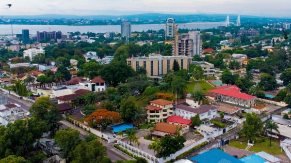
Accra Map: Key Locations, Traffic Hotspots, and Landmarks
Accra, the capital city, is a bustling metropolis. If you check Accra on Google Maps, you’ll find:
- Landmarks: Independence Arch, Makola Market, and the Kwame Nkrumah Memorial Park and Mausoleum.
- Traffic Hotspots: Areas like Circle (Kwame Nkrumah Interchange) and the Tetteh Quarshie roundabout often have heavy traffic.
- Major Roads: George Bush Highway, Liberation Road, and Spintex Road are key routes in the city.
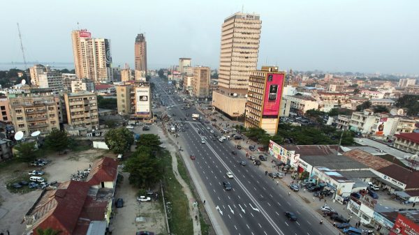
Kumasi Map: Important Roads and Points of Interest
Kumasi, the heart of the Ashanti Region, is rich in history and culture. On a map, you’ll see:
- Landmarks: Manhyia Palace, Kejetia Market, and the Kumasi Zoo.
- Busy Areas: Kejetia and Adum are commercial hubs where people buy and sell goods.
- Major Roads: Bantama High Street and Lake Road help navigate the city.
How to Use These Maps Effectively
Different maps serve different purposes. Knowing which one to use can save time and make travel easier.
Best Maps for Road Trips and Navigation
- Paper maps: Good for planning, especially when visiting remote areas with poor network coverage.
- GPS apps like Google Maps and Waze: Best for city driving and real-time traffic updates.
How to Access Up-to-Date Maps Online
To get the latest maps, try these sources:
- Google Maps: Available for free with internet access.
- Ghana Highway Authority: Provides road network updates.
- Tourism and travel websites: Offer printable maps and travel guides.
Maps are powerful tools that help us explore, navigate, and understand Ghana better. Whether it’s a political map showing the 16 regions, a road map guiding you between cities, or a topographic map explaining the landscape, each one serves a unique purpose. By using the right maps, you can travel smarter, plan better, and discover more about Ghana’s diverse geography.
For the most reliable maps, check official sources like the Ghana Highway Authority, online map services, or travel agencies. No matter where you’re headed, having the right map can make all the difference!
Subscribe to our Newsletter
Stay updated with the latest trends in African Pop Culture!